

Reports
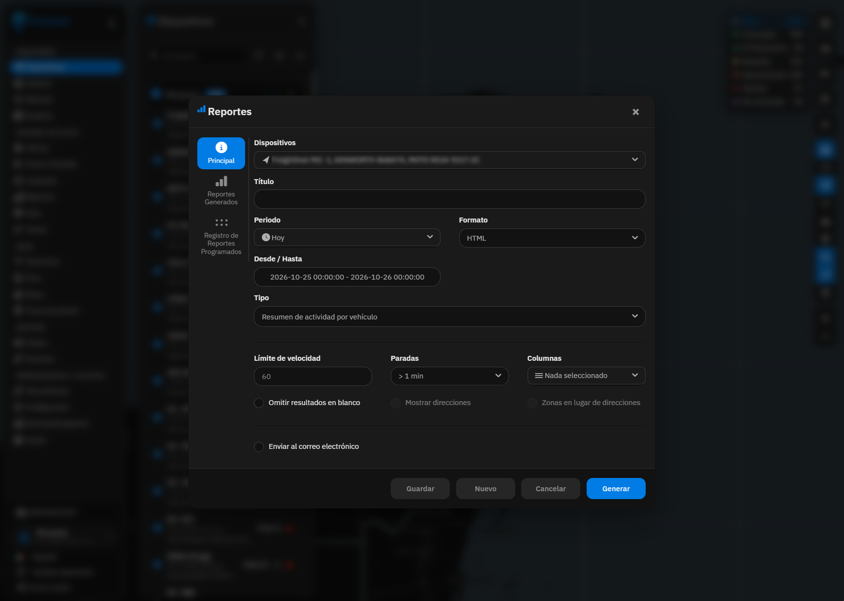
The report is built in one step
Period, format, speed limit and stops. Generate it now or leave it scheduled.
Discover every TrackeraX capability — tracking, video, alerts, white label, billing and more
The report form, the coverage area and the two-camera viewer.
Period, format, speed limit and stops. Generate it now or leave it scheduled.
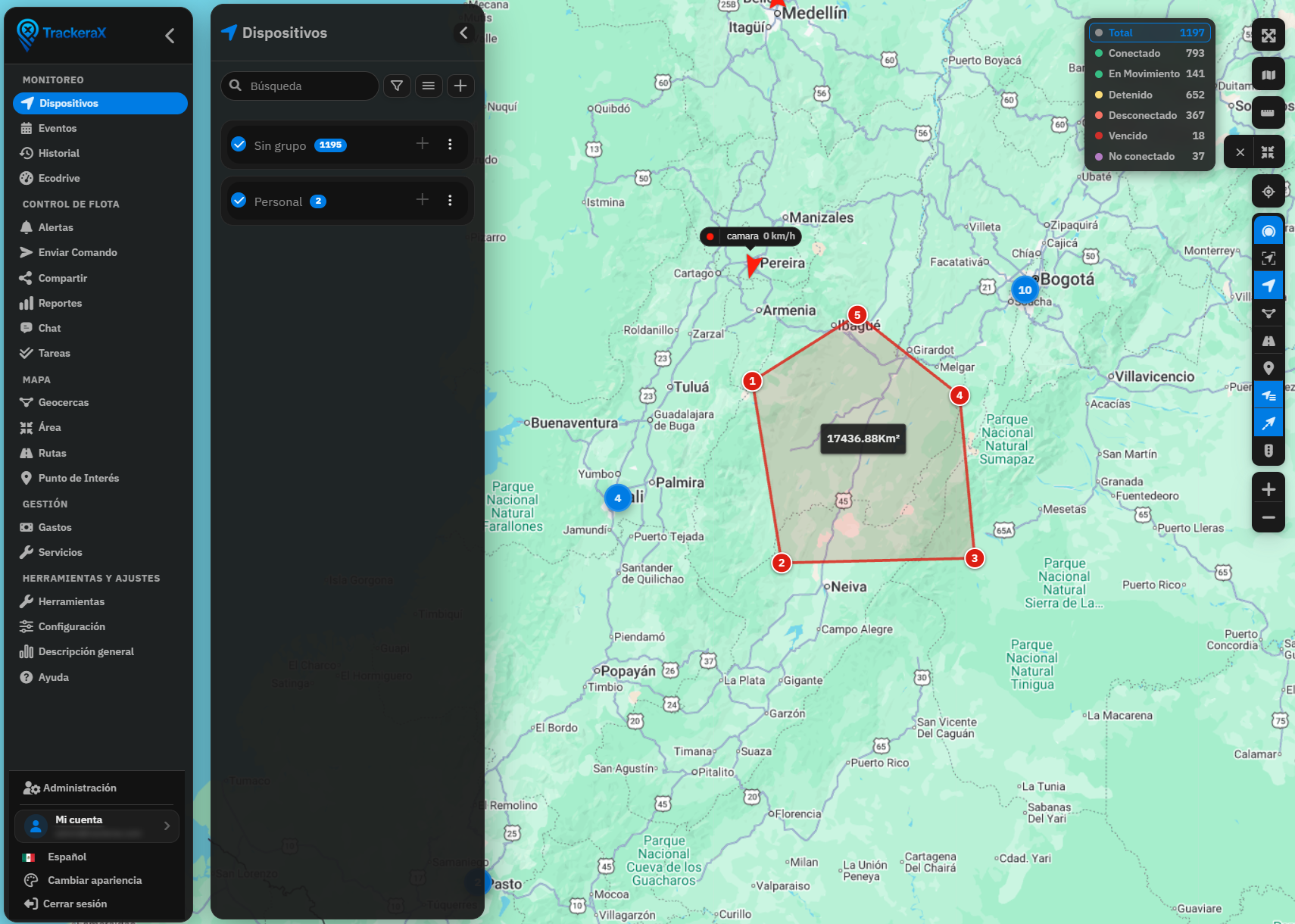
A working polygon, separate from a geofence, with the square kilometers measured.
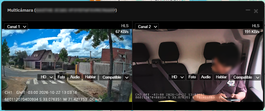
Road and cabin at once, with photo, audio and talk from the same viewer.
Live GPS positions on interactive maps with continuous updates of location, speed, heading and status. Device clustering, short trail history, status colors (moving/stopped/offline/engine/blocked), per-device live camera integration and multi-provider maps (Google, OSM, HERE, Azure, Mapbox, MapTiler and more).
Full vehicle and driver administration with multi-user roles, device assignment, vehicle groups, per-user limits and granular access control. Organizational hierarchies for companies with Managers, Operators and Supervisors across multiple levels.
Draw circular, polygonal or rectangular zones with automatic entry/exit alerts. Group geofences, import/export, schedule-aware rules and detailed in/out reports with driver and dwell-time data.
Per-device live video with channel selector, multi-camera grid, live audio and recording history. JT/T808 + JT/T1078 streaming (port 6015), Dahua cameras and MDVR, FTP media ingestion for snapshots/clips, ADAS/DMS event visibility and granular camera permissions.
90+ report types: distance, speed, fuel fill/theft, stops, trips, overspeed, odometer, engine hours, geofences, drivers, EcoDrive/RAG, DMS fatigue, utilization, expenses, checklists and more. Export PDF/Excel/CSV/JSON and schedule daily, weekly or monthly email delivery (optional FTP).
35+ sensor types: fuel tank/consumption, ignition, doors, seatbelt, RFID, VIN, odometer, engine hours, temperature, load, battery, GSM, satellites, harsh accel/brake/turn, route color, business/private drive and more. Calibration, rate-change alerts, history graphs and widget visibility control.
20+ alert types: overspeed, stop/move/idle, ignition, offline, geofence in/out, SOS, fuel fill/theft, sensor rate, unauthorized driver, task status, device expiration and protocol alarms. Channels: email, SMS, push (FCM), webhook, popup, sound, color highlight, auto GPRS command and sharing.
Send GPRS/SMS commands remotely with templates, bulk send, scheduled commands and protocol-grouped command lists. Pending command auto-resend when devices reconnect, command history with device replies and global template permissions.
Complete REST API for devices, history, geofences, routes, POIs, alerts, commands, tasks, chat, media, sharing, expenses and beacons. Token auth, alert webhooks, position forwards to third parties and lightweight device-list endpoints for reseller portals.
Full position and event history with interactive route playback, stops, arrows and event markers. Filter by device time or server receive time, dual-series graph comparison, export and restore from backups.
Create planned routes with points of interest, groups, import/export and map visualization. Compare planned vs actual paths, deviation analysis and dedicated route compliance reports.
Driver profiles with RFID/iButton identification, vehicle assignment, unauthorized-driver alerts and driver-change events. Per-driver activity, EcoDrive/RAG scoring and geofence in/out reports that include driver name, RFID and phone.
Assign jobs and locations to devices or drivers with automatic status changes based on presence. Task sets, sorting, export, status alerts and full compliance tracking for field operations.
Checklist templates with optional images, activity log and QR support (including pre-start checks). Checklist reports for audits and safety workflows before or after each trip.
Bluetooth Low Energy (BLE) beacons for asset and personnel tracking. Flespi/EYE decoding, proximity presence, expiration dates and dedicated API endpoints to list, create and edit beacons.
Custom POIs with categories, icons and descriptions. Map layers, idle/stop-at-POI alerts, POI duration reports, advanced search and import/export.
Google, OpenStreetMap, Bing, HERE, MapBox, MapTiler, TomTom, Azure, Carto, Esri, OpenTopo, OpenRailway and traffic hybrids. MapLibre/3D option, distance tool, LBS fallback, geocoding cache and custom overlays.
Embedded street-level panoramic view from the tracking screen so operators can inspect the real surroundings of any device without leaving the platform.
Email, SMS, Firebase FCM push (multi-project), webhooks, popup, sound and spoken TTS notifications per user. Customizable templates, schedules, expiration notices and channel management.
Admins and Managers send bulk announcements to their user base. Segment audience by users, tags or custom fields (no filter = everyone). Delivered through the notification stack including push, with logging in the admin notifications center.
Configurable HTTP gateway to plug in any SMS or messaging provider API (GET/POST). System-wide or per-user gateways so each operator can use their own sending endpoint for alerts and notifications — without locking you to a single vendor.
Time-limited public tracking links shareable by email/SMS/WhatsApp. Public Cards 2.0 with live preview, social links, image cropper and branded profile pages for resellers and end clients.
Export devices, reports, history, geofences, routes and more to PDF, Excel (XLSX), CSV or JSON. Choose fields, use templates and automate scheduled deliveries.
Driver behavior scoring with harsh acceleration, braking and turns. Trip timeline, RAG (Risk Assessment Grade) reports by fleet, driver or geofence, plus seatbelt-aware variants for safety programs.
Track device expenses by type with invoice numbers, fuel type and CO₂ emissions fields. Service intervals, maintenance schedules and expense reports for cost control.
Roles: Admin, Manager (reseller), User, Operator, Supervisor and Demo. Hierarchical managers (a manager can report to another), login-as, secondary credentials, login periods, one-session lock, 2FA and companies/clients/tags.
Granular view/edit/remove permissions per module: devices, reports, alerts, geofences, routes, drivers, tasks, cameras, SMS/GPRS templates, additional device fields and more. Billing-plan permission packs and inheritance.
Full branding for the platform and each Manager: logos (login, frontpage, domain), favicon, themes (TrackeraX, Monitor, Kiosk, Material, New Design…), template colors, welcome text, languages, email/SMS templates, app store links, CMS pages and popups. Resellers customize their own server identity without affecting the master.
User billing plans and per-device subscriptions with renewals and SIM expiry options. Payment gateways (PayPal, Stripe, Braintree, PayDunya, Paysera, 2Checkout, Asaas and more), self-registration, trials and configurable signup fields.
Toggleable plugins: speed-with-ignition, device always attached to creator, mobile geofence, automatic task status, geofence size display, live camera, visual expiration banners, business/private drive, spoken events, device location permission and more.
59 languages including Spanish, English, French, German, Italian, Portuguese, Russian, Chinese, Arabic, Korean, Kurdish, Ukrainian and more. Fully translated UI with admin translation tools and per-user language preference.
Scheduled automatic backups of positions and history, selective restore, database clear/retention tools and multi-database sharding for large fleets.
3,000+ GPS devices from 290+ manufacturers (Teltonika, Queclink, Ruptela, Suntech, Meitrack, Concox, JT/T808 and more). 280+ ports, advanced sensor decoding, remote commands, protocol migration with legacy continuity and continuous catalog updates.
In-app manual with 55+ pages covering tracking and admin areas (Spanish and English), plus quick module search (Ctrl/Cmd+K) and personalized side menus so operators find tools faster.